2nd Meeting Romney Marsh, Kent (UK) 2006 – Conference Report
2nd Meeting Romney Marsh, Kent (UK) 2006 – Conference Report
A joint INQUA – IGCP 495 Meeting
International Conference and Field Trip on:
Holocene land-ocean interactions: driving mechanisms and coastal responses
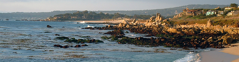
Romney Marsh & Dungeness Foreland
9th July – 12th July, 2006
A conference and field meeting to Romney Marsh and Dungeness, organized jointly by the UK working group of IGCP Project 495 and the INQUA Commission on Coastal and Marine Processes.
Conference Report
Introduction
Nestled in the picturesque town of Wye, Kent, Wye College provided the backdrop to the second annual meeting of the UK IGCP Working Group for IGCP project 495 (Quaternary Land-Ocean Interactions: Driving Mechanisms and Coastal Responses). The meeting was jointly organised by Antony Long (Durham University), Andy Plater (University of Liverpool), Martyn Waller (Kingston University) and Jason Kirby (Liverpool John Moores University). The meeting consisted of a one-day scientific session (consisting of both academic papers and posters), which was followed by a two day field trip to the coastal lowlands and gravel forelands of Romney Marsh and Dungeness.
The registration evening was somewhat unusual as it coincided with the 2006 World Cup Final. After initial ideas by the organisers to move the event, it was decided that perhaps the millions of television viewing public would be a little put out, so the delegates were instead treated to a postponed ‘welcome/poster’ session after a thrilling three hours of football with the occasional head-butt thrown in. The evening welcome, given by Antony after the penalties, promised a very full programme over the coming days. A brief background was given to research in the Romney and Dungeness area so as to both prepare and ‘wet the appetite’ for the two day field excursion.
Monday 10th July
The first full day of the conference was given over to the scientific meeting which was arranged into three thematic sessions, each detailed below:
Session 1 – Methodologies for reconstructing and dating
The first paper of the day was given by Robin Edwards (Trinity) on ‘Foraminiferal transfer functions and sea-level: Accuracy or precision?’ A stimulating first talk introduced by Robin as being “statistics after breakfast”. This didn’t put people off though and the second talk of the day, given by Wil Marshall (Plymouth), entitled ‘Dating recent salt-marsh sediments with radionuclides: a tentative look inside the ‘Black Box’’ caused a flurry of questions about the application of dating techniques in the coastal environment. This was followed by a presentation by Sarah Woodroffe (Durham) of her Doctoral work, ‘Foraminifera-based reconstructions of mid-late Holocene sea-level change from North Queensland, Australia’. This particular paper encouraged a lively debate to develop concerning the problems of the use of transfer functions in coastal studies, which integrated nicely with the first paper of the session given by Robin. Joseph Kelley (Maine) then gave a paper on the ‘Investigations of lower-than-present sea-level positions: Methods and results from Northern Ireland and Maine, USA’ which provided a fascinating insight into the use of vibro-cores, their relative positioning and absolute number considering the large costs involved. It served to highlight the growing need for high levels of pre-coring surveys where off-shore coring programmes are to be developed. The final paper of the session was given by Matthew Brain (Durham) who also presented work from his Doctoral work entitled ‘Autocompaction behaviour of mineralogenic intertidal sediments’. As with the start of the session, statistics made a comeback. Matthew carefully guided the audience through the various models for Autocompaction of salt marsh sediments and the inherent problems that currently belie the methodology used by many to adjust for altitudinal correction. It provided a fitting end to a session that served to highlight that methodologies for reconstructing sea level data are far from resolved.
Session 2 – Coastal resilience
The first paper of the second session was given by Roland Gehrels (Plymouth), and was concerned with ‘Coastal subsidence in southwest England’. Roland’s paper was aimed at current policy makers and their reliance on specific documents that essentially can be misleading. This talk provided an excellent start to the second session as a lively debate followed about the use of data and what actually makes a good sea level index point. The second paper of the session presented by Andrew Cooper (Ulster), ‘Beach morphological evolution during falling sea level: Millin Bay, Northern Ireland’, presented new evidence for a coastal site that had many in the audience wanting to visit the area. So much so, Andrew has been charged with the organisation of a future meeting of the IGCP to Northern Ireland to see his fantastic sites. The third paper was given by Simon Jennings (London Metropolitan University) and concentrated on the ‘Gravel transport along the East Sussex coast since the mid-Holocene’. The many different palaeogeographical maps that were presented were most fitting for this particular meeting as they provided further background to the coastal development of the area we were to visit on the two field days that were to follow. The fourth paper was given by Sytze van Heteren (TNO, Netherlands) and was a departure from the original advertisement due to a technical difficulty. The paper, entitled ‘Detailed marine mapping: channel fills and other small-scale features’ was an excellent stand by as it served to highlight the points made by Joseph in the first session about the need for detailed off-shore survey prior to expensive coring exercises. The next paper, given by Sue Dawson (St Andrews), was about ‘Sedimentological and geomorphological coastal change: evidence from the Jan 11th 2005 storm in the Outer Hebrides, NW Scotland’. Again, as with Andrew’s pictures of Northern Ireland, the Outer Hebrides stirred something in the audience and the Western Isles look like being yet another site for a future meeting. The final paper in this session was given by Jason Kirby (John Moores) and was entitled ‘Coastal response to Holocene water level changes in the Humber Estuary’. This paper introduced the idea of coastal lagoons developing in the peri-tidal zone and provided the backdrop for a lively debate about lagoonal sedimentation that continued over the break for tea.
Session 3 – Human coastal interactions
The final session began with an extremely interesting paper given by Vanessa Heyvaert (Geological Survey of Belgium) on ‘The impact of channel shifting of the river Karkheh on the late Holocene evolution of the northern part of the Lower Khuzestan plain (Persian Gulf, SW Iran): integrating geological and historical data’. The integration of geomorphology and archaeology/historical record was impressive in an area that essentially saw the birth of civilisation. The constant thought of working in the border country between Iran and Iraq was quite daunting. The second paper saw another of the Dutch contingent from TNO Built Environment and Geosciences, Geological Survey of the Netherlands, Peter Vos, present a paper on ‘Geoarchaeology and palaeogeography of the northern Netherlands’. It should perhaps be pointed out at this stage that our IGCP European partners supported the Romney Marsh meeting extremely well and constantly provided excellent feedback and questioning of all the papers presented. Peter’s paper was based around the ‘geogenetic approach’ which saw a high level of integration between geology, geomorphology and archaeology in order to reconstruct palaeoenvironments. The final paper of the session and indeed the day was given by Henk Weerts (TNO, Netherlands). Henk’s paper, ‘The engulfing of the Groote Waard (The Netherlands)’, was thought provoking as it took historical reference and folklore of coastal flooding events in the Netherlands, and with the aid of high resolution geological work, aimed to prove and disprove certain theories with the production of a number of palaeogeographical maps.
The day was rounded off with a trip to Lympne Castle where the conference dinner was served in magnificent surroundings overlooking the coastal area of Romney Marsh (obscured slightly by the rain and low cloud). The castle setting was quite spectacular and was rounded off by a presentation by Andy Plater (aided by Jason Kirby) of the entire delegates alter egos via a very amusing set of web-based searches. It was amazing to learn of our exploits outside of our academic lives thanks to our namesakes, although some were worried what the web would associate with our names due to previous Google-search exploits.
Tuesday 11th July
With the scientific sessions over, the second day of the meeting was devoted to field visits in the Romney Marsh area. We were all provided with a large ‘Field Guide and Abstracts’ document that will no doubt provide many hours of light reading for the weeks that follow the trip. The provision of vast amounts of maps and diagrams to everybody was excellent though and helped no end with an understanding of the geomorphology of the area.
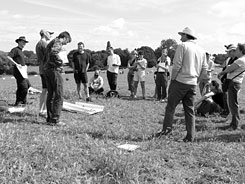
The first stop was Appledore (Mill Mount) where the four field trip leaders, Antony Long, Martyn Waller, Andy Plater and Jason Kirby, introduced the early Holocene history of the Romney Marsh depositional complex whilst overlooking Walland and Romney Marshes (see Plate 1).
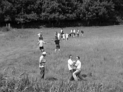
The second stop of the day was Pett Level (Wickham Manor). Here, Martyn Waller explained the destruction of the late Holocene wetlands and the first of a number of ‘hands-on’ coring exercises was undertaken (see Plate 2). The group coring exercise produced mixed results that were blamed on a number of different things, involving over enthusiastic coring technique, lack of coring technique or perhaps the wrong technique. All in all the English summer weather was perhaps too much for some coupled with the strain of penetrating the metre or so of hard clay.
The lunch stop at Old Winchelsea provided another excellent opportunity to look out across Romney Marsh, further strengthening the understanding of the surroundings in relation to the extensive research that has been undertaken in the area. Although incredibly complex, the depositional history was starting to make sense.
The third main stop of the day, Moneypenney Farm and Walland Marsh, saw Martyn Waller and Antony Long introduce the history to the tidal inlets and tidal channels that underlie the area. A further coring exercise was undertaken with the supervision of Andy Plater in order to investigate fine laminations in the infilling of the Wainway Channel. Again, mixed results made sure that those with the incorrect technique were not allowed near the coring equipment again! Andy was quick to point out that the deposits were somewhat sporadic and perhaps not everybody should have found the same sedimentary, signal although it was felt that perhaps he was being somewhat accommodating.
The final stop of the day was at Jury’s Gap where Andy Plater introduced the barrier/marshland interface. A short talk about SSSI designation was given by Brian Banks (English Nature) who pointed out that of the many SSSIs around the country, few are given over to geomorphological/geological areas.
Wednesday 12th July
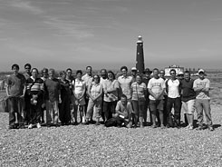
Plate 3. The delegates of the 2006 IGCP 495 UK working group meeting on the Dungeness Foreland, overlooking the Dungeness Lighthouse
(Photo courtesy of Roland Gehrels)
The focus for the final day of the field trip was the coastal fringe of Dungeness. The first stop of the day was at the Dungeness Foreland (Muddymore Pit), where Andy Plater gave a complete depositional history of the area. We were all treated to a plethora of talks about the palaeoreconstruction of the Foreland area with a number of demonstrations of the sediments that can be found in-between the shingle ridges. One of the particular demonstrations that will stay with many, involved Anthony Long introducing us all to the ‘leaping’ technique of gouge coring, effective but perhaps far too energetic for some.
The next stop at the Dungeness Lighthouse allowed everybody to get a fantastic view of both the shingle deposition in the area and the imposing figure that is Dungeness nuclear power station. This was followed by an introduction to the coastal management of Dungeness by members of the shoreline management committee who also represented English Nature and the Power Company. The need for shingle dredging and beach nourishment was obvious in terms of protecting the nuclear power installation, but to hear how policy is constantly changing made many baulk at the prospects for the future of the area. As this was the last stop, it was decided that it would make a fitting place to take a group photo (see Plate 3). It was felt that this IGCP meeting was both productive and enjoyable and all involved thanked the organisers for such a marvellous effort.
For more information and / or free membership of IGCP Project 495, please contact Roland Gehrels ([email protected]).
Jason Jordan
Department of Geography
Environment & Disaster Management
Coventry University